


RandoCartes — general settings
The page for managing application settings is displayed when you click on the General settings option in the main menu when the map is displayed.
It will look something like this:
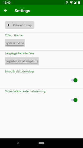
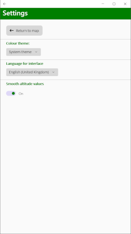
The different settings that you can change are explained below.
Colour theme
This setting is used to define the appearance of the application.
Three values are possible:
System theme: the application will use a colour scheme based on that defined by the operating system
Light: dark text on a light background
Dark: light text on a dark background
Interface language
This setting indicates the language that will be used by the application.
The option “Default system language” sets the language to that of your device, if possible, otherwise English is used.
Action on return to start
This setting indicates what action the application will take when you are tracking your walk and you get back to your starting point.
The following options are possible:
No action: the application will just continue recording your movements exactly as it was already doing
Alarm: the application will emit a warning sound to remind you to stop the recording of your walk. The alarm will continue to sound until either you touch the orange bar at the bottom of the map or until you select the Tracking control option in the menu.
Save trail: the application will automatically stop tracking and save the trail as if you had requested it to in the menu. Only use this option if your GPS receiver is sufficiently stable to not jump around too much and trigger the option prematurely.
Action when paused
This setting indicates what action the application will take when you have paused tracking and you move away from the position where you paused tracking.
The following options are possible:
No action: recording will remain paused
Alarm: the application will emit a warning sound to remind you to restart the recording of your walk. The alarm will continue to sound until either you touch the pink bar at the bottom of the map or until you select the Tracking control option in the menu.
Restart recording: the application will automatically restart tracking. Only use this option if your GPS receiver is sufficiently stable to not jump around too much and trigger the option prematurely.
Smooth altitude values
On devices that do not have an altimeter, values of altitude will be calculated by the GPS system and will not always be exact, often jumping around wildly. If you enable this option the application will seek to smooth the altitude values to give a more stable value.
External memory (Android only)
The option “store data on external memory” is only available under Android. If you select this option, application data will be stored on external memory instead of the device’s internal memory.
Import/Export app settings
These options allow you to export all the application data (trails, points of interest, services and settings) to a file. This file can then be used to import all (or a selection of) this data back into the application on the same, or a different, device.
When you change phones, for example, you can transfer all of your data from the old one to the new one very easily. The exported file is a zip file that contains all of your trails in GPX format. You can therefore also use it to do a mass export of your trails into another application.
To export all of your settings, press the Export button. You will be asked to supply the name of the file to save to. Once this is done the file will be created.
To import a previously exported file, press the Import button. You will be asked to select the file you wish to import from. One you have done this, you will be allowed to select which information you wish to import.
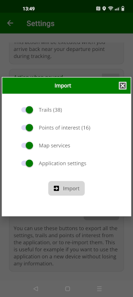
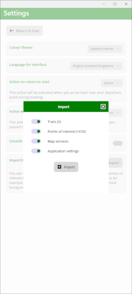
The numbers after “trails” and “points of interest” indicate how many of each exist in the file. By default all categories are selected (unless a category is empty in the file), but you can unselect the categories you do not which to import. When you press Import the selected categories will be imported into the application.